|
|
Post by Charity on Sept 13, 2005 10:41:16 GMT -5
Redoing this adventure club for 2012. Egypt will be our first country.
|
|
|
|
Post by Charity on Sept 13, 2005 10:49:34 GMT -5
Geography Egypt Top of Page
Location:
Northern Africa, bordering the Mediterranean Sea, between Libya and the Gaza Strip, and the Red Sea north of Sudan, and includes the Asian Sinai Peninsula
Geographic coordinates:
27 00 N, 30 00 E
Map references:
Africa
Area:
total: 1,001,450 sq km
land: 995,450 sq km
water: 6,000 sq km
Area - comparative:
slightly more than three times the size of New Mexico
Land boundaries:
total: 2,665 km
border countries: Gaza Strip 11 km, Israel 266 km, Libya 1,115 km, Sudan 1,273 km
Coastline:
2,450 km
Maritime claims:
territorial sea: 12 nm
contiguous zone: 24 nm
exclusive economic zone: 200 nm
continental shelf: 200-m depth or to the depth of exploitation
Climate:
desert; hot, dry summers with moderate winters
Terrain:
vast desert plateau interrupted by Nile valley and delta
Elevation extremes:
lowest point: Qattara Depression -133 m
highest point: Mount Catherine 2,629 m
Natural resources:
petroleum, natural gas, iron ore, phosphates, manganese, limestone, gypsum, talc, asbestos, lead, zinc
Land use:
arable land: 2.87%
permanent crops: 0.48%
other: 96.65% (2001)
Irrigated land:
33,000 sq km (1998 est.)
Natural hazards:
periodic droughts; frequent earthquakes, flash floods, landslides; hot, driving windstorm called khamsin occurs in spring; dust storms, sandstorms
Environment - current issues:
agricultural land being lost to urbanization and windblown sands; increasing soil salination below Aswan High Dam; desertification; oil pollution threatening coral reefs, beaches, and marine habitats; other water pollution from agricultural pesticides, raw sewage, and industrial effluents; very limited natural fresh water resources away from the Nile which is the only perennial water source; rapid growth in population overstraining the Nile and natural resources
Environment - international agreements:
party to: Biodiversity, Climate Change, Climate Change-Kyoto Protocol, Desertification, Endangered Species, Environmental Modification, Hazardous Wastes, Law of the Sea, Marine Dumping, Ozone Layer Protection, Ship Pollution, Tropical Timber 83, Tropical Timber 94, Wetlands
signed, but not ratified: none of the selected agreements
Geography - note:
controls Sinai Peninsula, only land bridge between Africa and remainder of Eastern Hemisphere; controls Suez Canal, a sea link between Indian Ocean and Mediterranean Sea; size, and juxtaposition to Israel, establish its major role in Middle Eastern geopolitics; dependence on upstream neighbors; dominance of Nile basin issues; prone to influxes of refugees
|
|
|
|
Post by Charity on Sept 13, 2005 10:50:28 GMT -5
Flag Description: three equal horizontal bands of red (top), white, and black; the national emblem (a gold Eagle of Saladin facing the hoist side with a shield superimposed on its chest above a scroll bearing the name of the country in Arabic) centered in the white band; design is based on the Arab Liberation flag and similar to the flag of Syria, which has two green stars, Iraq, which has three green stars (plus an Arabic inscription) in a horizontal line centered in the white band, and Yemen, which has a plain white band 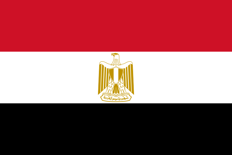 |
|
|
|
Post by Charity on Sept 13, 2005 10:59:16 GMT -5
|
|
|
|
Post by Charity on Sept 13, 2005 11:03:06 GMT -5
|
|
|
|
Post by Charity on Sept 13, 2005 11:12:38 GMT -5
|
|
|
|
Post by Charity on Sept 13, 2005 11:42:18 GMT -5
|
|
|
|
Post by Charity on Sept 13, 2005 11:44:18 GMT -5
|
|
|
|
Post by Charity on Sept 13, 2005 11:46:41 GMT -5
|
|
|
|
Post by Charity on Sept 13, 2005 12:23:31 GMT -5
|
|
|
|
Post by Charity on Sept 13, 2005 12:27:36 GMT -5
|
|
|
|
Post by Charity on Sept 13, 2005 12:34:57 GMT -5
GEOGRAPHY TEST---COUNTRIES
NAME___________________________DATE________________________
1. THIS WEEK OUR COUNTRY IS________________________________.
2. THIS COUNTRY IS LOCATED ON WHAT CONTINENT___________________________________________________.
3. THIS COUNTRY IS GOVERNED BY WHAT KIND OF POLITICAL SYSTEM?_____________________________________________________________________
4. WHO IS THE LEADER OF THIS COUNTRY?____________________________
5. WHAT IS THE PRIMARY LANGUAGE SPOKEN HERE?_____________________________________________________________________.
6. WHAT KIND OF ECONOMY DOES THIS COUNTRY HAVE?_____________________________________________________________________________________________________________________________________________.
7. WHAT ARE SOME (AT LEAST 3) OF THE NATURAL RESOURCES ABUNDANT IN THIS COUNTRY?____________________________________________________________________________________________________________________________________________________________________________________________________________________.
8. WHAT IS THE PRIMARY RELIGION OF THIS COUNTRY?_____________________________________________________________________.
9. WHAT IS THE APPROXOMATE POPULATION OF THIS COUNTRY?____________________________________________________________________.
IN YOUR OWN WORDS, EXPLAIN WHY YOU WOULD OR WOULD NOT WISH TO VISIT THIS COUNTRY. WHAT KINDS OF FOOD WOULD YOU EAT THERE, AND WHAT FAMOUS PLACES OF INTEREST WOULD YOU LIKE TO SEE.________________________________________________________________________________________________________________________________________________________________________________________________________________________________________________________________________________________________________________________________________________
WHAT IS THIS COUNTRIES’ CAPITOL CITY_______________________________________
12. WHAT KIND OF MONEY IS USED HERE?________________________________________
|
|
|
|
Post by Charity on Sept 13, 2005 12:41:02 GMT -5
GEOGRAPHY-COUNTRY-WEEKLY STUDY SHEET
NAME__________________________DATE____________
COUNTRY OF THE WEEK___________________________________________
THIS COUNTRY IS LOCATED IN THE CONTINENT OF______________________
THIS COUNTRY IS GOVERNED BY WHAT KIND OF POLITICAL SYSTEM________________________________________
WHO IS THE LEADER OF THIS COUNTRY______________________________
IS THERE ONLY ONE LEADER_________IS THIS COUNTRY A DICTATORSHIP, DEMOCRACY OR WHAT_____________________________________________.
WHAT IS THE PRIMARY LANGUAGE SPOKEN HERE_____________________________________________
WHAT IS THE ECONOMY LIKE_____________________________________________
DO THE PEOPLE HAVE ANY STRANGE OR UNUSUAL CUSTOMS________________________________________
WHAT ARE SOME OF THIER NATURAL RESOURCES______________________________________
WHAT IS THE PRIMARY RELIGION PRACTICED HERE__________________________________________
WOULD THIS BE A GOOD COUNTRY TO SEND IN CHRISTIAN MISSIONARIES__________________________________
WHAT IS THE POPULATION LIKE_____________________________________
WHAT KIND OF FOODS (AT LEAST 3) WOULD YOU EAT IF YOU WERE TO VISIT THIS COUNTRY______________________________________
WHAT IS THE CAPITOL OF THIS COUNTRY_______________________________
NAME 2 OF THE LARGEST CITIES_______________________________________
CAN YOU FIND THIS COUNTRY ON THE MAP_________________DO IT.
|
|
|
|
Post by Charity on Sept 13, 2005 12:58:16 GMT -5
|
|
|
|
Post by Charity on Sept 13, 2005 13:05:55 GMT -5
Egyptian Mummies The methods of embalming, or treating the dead body, that the ancient Egyptians used is called mummification. Using special processes, the Egyptians removed all moisture from the body, leaving only a dried form that would not easily decay. It was important in their religion to preserve the dead body in as life-like a manner as possible. So successful were they that today we can view the mummified body of an Egyptian and have a good idea of what he or she looked like in life, 3000 years ago. Mummification was practiced throughout most of early Egyptian history. The earliest mummies from prehistoric times probably were accidental. By chance, dry sand and air (since Egypt has almost no measurable rainfall) preserved some bodies buried in shallow pits dug into the sand. About 2600 B.C., during the Fourth and Fifth Dynasties, Egyptians probably began to mummify the dead intentionally. The practice continued and developed for well over 2,000 years, into the Roman Period (ca. 30 B.C. - A.D. 364). Within any one period the quality of the mummification varied, depending on the price paid for it. The best prepared and preserved mummies are from the Eighteenth through the Twentieth Dynasties of the New Kingdom (ca. 1570 - 1075 B.C.) and include those of Tutankhamen and other well-known pharaohs. It is the general process of this period that shall be described here. Process The mummification process took seventy days. Special priests worked as embalmers, treating and wrapping the body. Beyond knowing the correct rituals and prayers to be performed at various stages, the priests also needed a detailed knowledge of human anatomy. The first step in the process was the removal of all internal parts that might decay rapidly. The brain was removed by carefully inserting special hooked instruments up through the nostrils in order to pull out bits of brain tissue. It was a delicate operation, one which could easily disfigure the face. The embalmers then removed the organs of the abdomen and chest through a cut usually made on the left side of the abdomen. They left only the heart in place, believing it to be the center of a person's being and intelligence. The other organs were preserved separately, with the stomach, liver, lungs, and intestines placed in special boxes or jars today called canopic jars. These were buried with the mummy. In later mummies, the organs were treated, wrapped, and replaced within the body. Even so, unused canopic jars continued to be part of the burial ritual. more and pictures here: www.si.edu/resource/faq/nmnh/mummies.htm |
|

